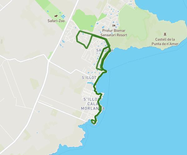
This running route covers 3.743mi starting from Sant Llorenç des Cardassar, Balearic Islands. The run does not return to the trailhead and ends near Passeig De Sa Platja De Sa Coma, 07560 Sant Llorenç des Cardassar, Balearic Islands, Spain. This run is rated as easy, expect about 40m9s to complete it. The route has an elevation gain of 246ft and an elevation loss of 243ft.
Sa Coma 6 km
Route details
5.59mph
Speed
459 kcal
Calories burned
Point to point
Route type
-3ft
Min altitude
33ft
Max altitude
Route profile
246ft
Elevation gain
243ft
Elevation loss
-3ft
Min altitude
33ft
Max altitude
How to get there
Trailhead: Avinguda De Les Savines 86, 07560 Sant Llorenç des Cardassar, Balearic Islands, Spain
GPS coordinates of the trailhead: 39.573738, 3.373788 / 39°34'25'' N, 3°22'25'' E