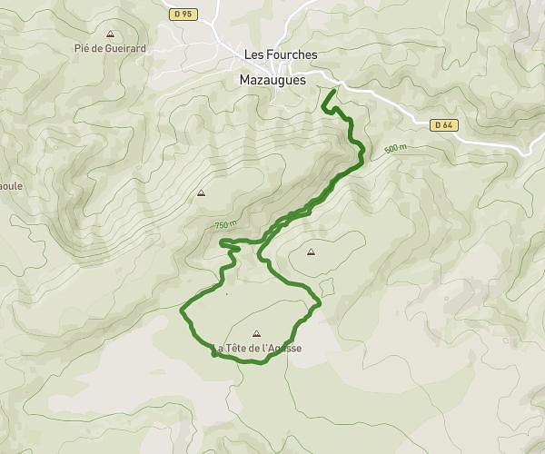
This hiking trail covers 7.461mi starting from Pignans, Var. The hike is a loop trail and returns to the trailhead. This hike is rated as strenuous, plan for about 3h42m to complete it. The route has an elevation gain of 1942ft and an elevation loss of 1939ft.
Pignans
Route details
2.02mph
Speed
1682 kcal
Calories burned
9.9%
Avg grade
Loop trail
Route type
699ft
Min altitude
2516ft
Max altitude
Steep climb
Route profile
1942ft
Elevation gain
1939ft
Elevation loss
699ft
Min altitude
2516ft
Max altitude
How to get there
Trailhead: Piste Vallon Notre-Dame, 83790 Pignans, France
GPS coordinates of the trailhead: 43.29301, 6.25934 / 43°17'34'' N, 6°15'33'' E