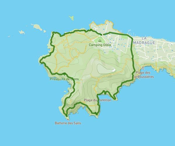
This hiking trail covers 4.755mi starting from Hyères, Var. The hike is a loop trail and returns to the trailhead. This hike is rated as moderate, plan for about 2h51m to complete it. The route has an elevation gain of 732ft and an elevation loss of 732ft.
château escaliers
Route details
1.67mph
Speed
1255 kcal
Calories burned
5.8%
Avg grade
Loop trail
Route type
135ft
Min altitude
564ft
Max altitude
Route profile
732ft
Elevation gain
732ft
Elevation loss
135ft
Min altitude
564ft
Max altitude
How to get there
Trailhead: 5 Rue Du Docteur Roux Seignoret, 83400 Hyères, France
GPS coordinates of the trailhead: 43.12075, 6.13117 / 43°7'14'' N, 6°7'52'' E