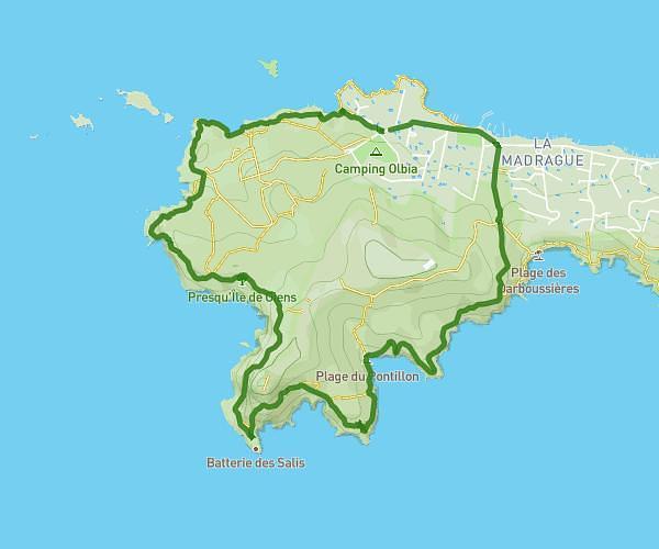
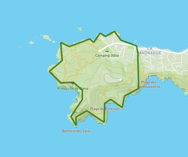
This hiking trail covers 5.375mi starting from Six-Fours-les-Plages, Var. The hike is a loop trail and returns to the trailhead. This hike is rated as easy, plan for about 2h9m to complete it. The route has an elevation gain of 269ft and an elevation loss of 272ft.
CAP NEGRE
Route details
2.49mph
Speed
923 kcal
Calories burned
1.9%
Avg grade
Loop trail
Route type
0ft
Min altitude
36ft
Max altitude
Route profile
269ft
Elevation gain
272ft
Elevation loss
0ft
Min altitude
36ft
Max altitude
How to get there
Trailhead: 949 Avenue Des Palmiers, 83140 Six-Fours-les-Plages, France
GPS coordinates of the trailhead: 43.077129, 5.804567 / 43°4'37'' N, 5°48'16'' E