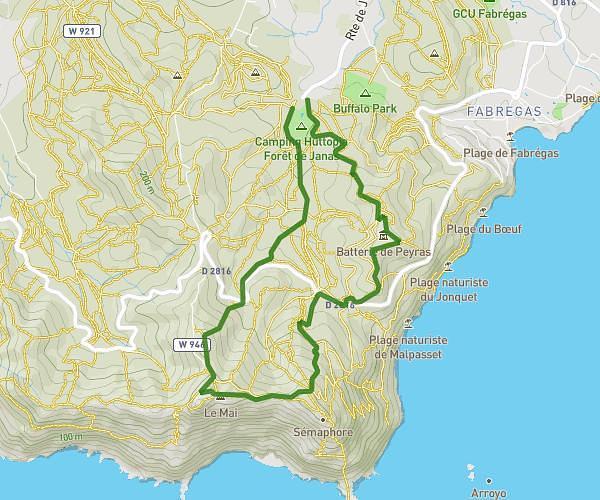
This hiking trail covers 4.413mi starting from Hyères, Var. The hike is a loop trail and returns to the trailhead. This hike is rated as moderate, plan for about 1h53m to complete it. The route has an elevation gain of 1004ft and an elevation loss of 1007ft.
Randon1
Route details
2.34mph
Speed
848 kcal
Calories burned
8.6%
Avg grade
Loop trail
Route type
-3ft
Min altitude
279ft
Max altitude
Steep climb
Route profile
1004ft
Elevation gain
1007ft
Elevation loss
-3ft
Min altitude
279ft
Max altitude
How to get there
Trailhead: 114 Chemin De La Table Ronde, 83400 Hyères, France
GPS coordinates of the trailhead: 43.03841, 6.11019 / 43°2'18'' N, 6°6'36'' E