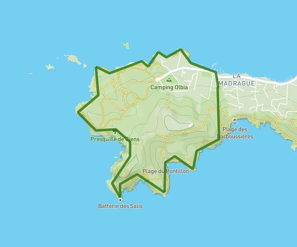
This hiking trail covers 4.168mi starting from Hyères, Var. The hike is a loop trail and returns to the trailhead. This hike is rated as moderate, plan for about 1h8m to complete it. The route has an elevation gain of 1024ft and an elevation loss of 1020ft.
Giens Ouest
Route details
3.68mph
Speed
513 kcal
Calories burned
9.3%
Avg grade
Loop trail
Route type
0ft
Min altitude
279ft
Max altitude
Steep climb
Route profile
1024ft
Elevation gain
1020ft
Elevation loss
0ft
Min altitude
279ft
Max altitude
How to get there
Trailhead: 472 Avenue René De Knyff, 83400 Hyères, France
GPS coordinates of the trailhead: 43.040042, 6.104057 / 43°2'24'' N, 6°6'14'' E