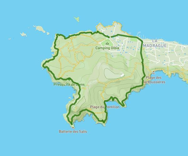
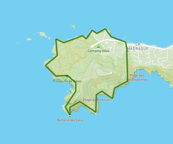
This hiking trail covers 4.35mi starting from La Seyne-sur-Mer, Var. The hike is a loop trail and returns to the trailhead. This hike is rated as hard, plan for about 2h4m to complete it. The route has an elevation gain of 1106ft and an elevation loss of 1115ft.
Rando Le Mai
Route details
2.11mph
Speed
938 kcal
Calories burned
9.7%
Avg grade
Loop trail
Route type
269ft
Min altitude
1089ft
Max altitude
Steep climb
Route profile
1106ft
Elevation gain
1115ft
Elevation loss
269ft
Min altitude
1089ft
Max altitude
How to get there
Trailhead: Piste De La Batterie De Peyras, 83500 La Seyne-sur-Mer, France
GPS coordinates of the trailhead: 43.071331, 5.854618 / 43°4'16'' N, 5°51'16'' E