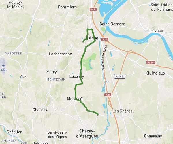
This running route covers 4.47mi starting from Limas, Rhône. The run is a loop trail and returns to the trailhead. This run is rated as easy, expect about 59m to complete it. The route has an elevation gain of 584ft and an elevation loss of 584ft.
1er sortie training jura
Route details
4.54mph
Speed
675 kcal
Calories burned
Loop trail
Route type
669ft
Min altitude
1020ft
Max altitude
Route profile
584ft
Elevation gain
584ft
Elevation loss
669ft
Min altitude
1020ft
Max altitude
How to get there
Trailhead: 6 Rue Du 11 Novembre 1918, 69400 Limas, France
GPS coordinates of the trailhead: 45.976228, 4.710925 / 45°58'34'' N, 4°42'39'' E