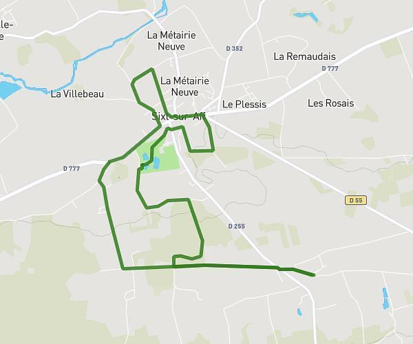
This hiking trail covers 6.278mi starting from Sixt-sur-Aff, Ille-et-Vilaine. The hike is a loop trail and returns to the trailhead. This hike is rated as easy, plan for about 2h12m to complete it. The route has an elevation gain of 351ft and an elevation loss of 354ft.
Lolo
Route details
2.85mph
Speed
940 kcal
Calories burned
2.1%
Avg grade
Loop trail
Route type
46ft
Min altitude
203ft
Max altitude
Route profile
351ft
Elevation gain
354ft
Elevation loss
46ft
Min altitude
203ft
Max altitude
How to get there
Trailhead: 13 Lourme De Noyal, 35550 Sixt-sur-Aff, France
GPS coordinates of the trailhead: 47.808792, -2.053816 / 47°48'31'' N, 2°3'13'' W