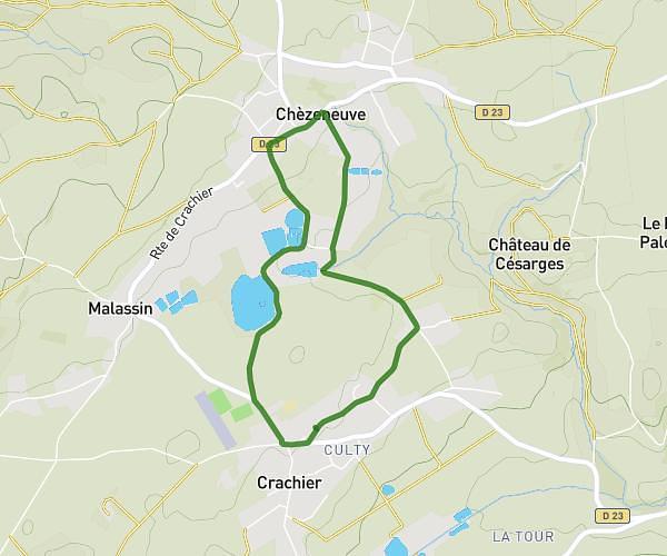
This walking route covers 4.204mi starting from Chaponnay, Rhône. The walk is a loop trail and returns to the trailhead. This walk is rated as moderate, plan for about 1h30m to complete it. The route has an elevation gain of 430ft and an elevation loss of 427ft.
chevrerie marennes
Route details
21:25/mi
Pace
368 kcal
Calories burned
Loop trail
Route type
696ft
Min altitude
1093ft
Max altitude
Route profile
430ft
Elevation gain
427ft
Elevation loss
696ft
Min altitude
1093ft
Max altitude
How to get there
Trailhead: Rue Centrale, 69970 Chaponnay
GPS coordinates of the trailhead: 45.6273, 4.93511 / 45°37'38'' N, 4°56'6'' E