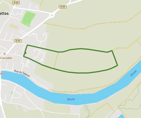
This walking route covers 1.525mi starting from Loyettes, Ain. The walk is a loop trail and returns to the trailhead. This walk is rated as easy, plan for about 29m27s to complete it. The route has an elevation gain of 36ft and an elevation loss of 36ft.
2400m
Route details
19:19/mi
Pace
120 kcal
Calories burned
Loop trail
Route type
620ft
Min altitude
636ft
Max altitude
Route profile
36ft
Elevation gain
36ft
Elevation loss
620ft
Min altitude
636ft
Max altitude
How to get there
Trailhead: Impasse Ronsard, 01360 Loyettes
GPS coordinates of the trailhead: 45.77509, 5.21063 / 45°46'30'' N, 5°12'38'' E