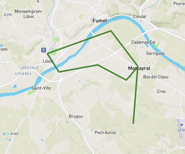
This running route covers 5.609mi starting from Montayral, Lot-et-Garonne. The run is a loop trail and returns to the trailhead. This run is rated as moderate, expect about 1h10s to complete it. The route has an elevation gain of 581ft and an elevation loss of 571ft.
Dénivelé
Route details
5.59mph
Speed
688 kcal
Calories burned
Loop trail
Route type
240ft
Min altitude
656ft
Max altitude
Route profile
581ft
Elevation gain
571ft
Elevation loss
240ft
Min altitude
656ft
Max altitude
How to get there
Trailhead: 177 Avenue Du Lot, 47500 Montayral, France
GPS coordinates of the trailhead: 44.481621, 0.987291 / 44°28'53'' N, 0°59'14'' E