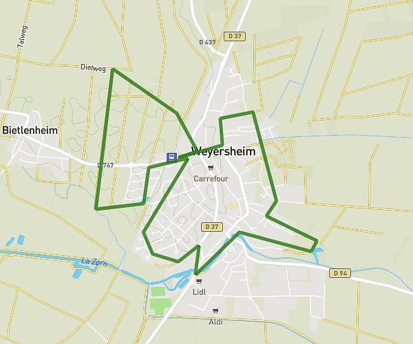
This running route covers 1.327mi starting from Ingwiller, Bas-Rhin. The run is a loop trail and returns to the trailhead. This run is rated as easy, expect about 19m to complete it. The route has an elevation gain of 92ft and an elevation loss of 92ft.
Run
Route details
4.19mph
Speed
217 kcal
Calories burned
Loop trail
Route type
597ft
Min altitude
646ft
Max altitude
Route profile
92ft
Elevation gain
92ft
Elevation loss
597ft
Min altitude
646ft
Max altitude
How to get there
Trailhead: Rue Des Rameaux, 67340 Ingwiller
GPS coordinates of the trailhead: 48.87613, 7.47873 / 48°52'34'' N, 7°28'43'' E