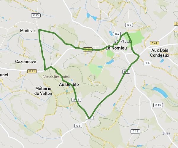
This running route covers 3.005mi starting from La Romieu, Gers. The run is a loop trail and returns to the trailhead. This run is rated as easy, expect about 30m to complete it. The route has an elevation gain of 226ft and an elevation loss of 230ft.
Classic Alice
Route details
6.01mph
Speed
343 kcal
Calories burned
Loop trail
Route type
584ft
Min altitude
702ft
Max altitude
Route profile
226ft
Elevation gain
230ft
Elevation loss
584ft
Min altitude
702ft
Max altitude
How to get there
Trailhead: Le Camp De Florence, 32480 La Romieu
GPS coordinates of the trailhead: 43.98312, 0.50182 / 43°58'59'' N, 0°30'6'' E