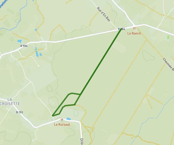
This walking route covers 2.128mi starting from Saint-Amand-les-Eaux, Nord. The walk does not return to the trailhead and ends near Rue Des Tisseurs, 59230 Saint-Amand-les-Eaux. This walk is rated as easy, plan for about 46m to complete it. The route has an elevation gain of 92ft and an elevation loss of 82ft.
Dst
Route details
21:36/mi
Pace
188 kcal
Calories burned
Point to point
Route type
52ft
Min altitude
72ft
Max altitude
Route profile
92ft
Elevation gain
82ft
Elevation loss
52ft
Min altitude
72ft
Max altitude
How to get there
Trailhead: Rue Henri Dunant, 59230 Saint-Amand-les-Eaux
GPS coordinates of the trailhead: 50.44698, 3.42567 / 50°26'49'' N, 3°25'32'' E