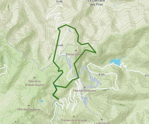
This walking route covers 7.82mi starting from Lepuix, Territoire de Belfort. The walk is a loop trail and returns to the trailhead. This walk is rated as strenuous, plan for about 2h48m to complete it. The route has an elevation gain of 1982ft and an elevation loss of 1985ft.
tour du Ballon d'Alsace depuis parking
Route details
21:30/mi
Pace
686 kcal
Calories burned
Loop trail
Route type
2582ft
Min altitude
3737ft
Max altitude
Route profile
1982ft
Elevation gain
1985ft
Elevation loss
2582ft
Min altitude
3737ft
Max altitude
How to get there
Trailhead: D 465, 90200 Lepuix, France
GPS coordinates of the trailhead: 47.801375, 6.833763 / 47°48'4'' N, 6°50'1'' E