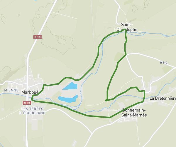
This running route covers 3.241mi starting from La Ville-aux-Clercs, Loir-et-Cher. The run is a loop trail and returns to the trailhead. This run is rated as easy, expect about 31m to complete it. The route has an elevation gain of 154ft and an elevation loss of 154ft.
La Vac 19/08 soir
Route details
6.28mph
Speed
354 kcal
Calories burned
Loop trail
Route type
443ft
Min altitude
502ft
Max altitude
Route profile
154ft
Elevation gain
154ft
Elevation loss
443ft
Min altitude
502ft
Max altitude
How to get there
Trailhead: 12 Rue De La Tutinière, 41160 La Ville-aux-Clercs, France
GPS coordinates of the trailhead: 47.91496, 1.07965 / 47°54'53'' N, 1°4'46'' E