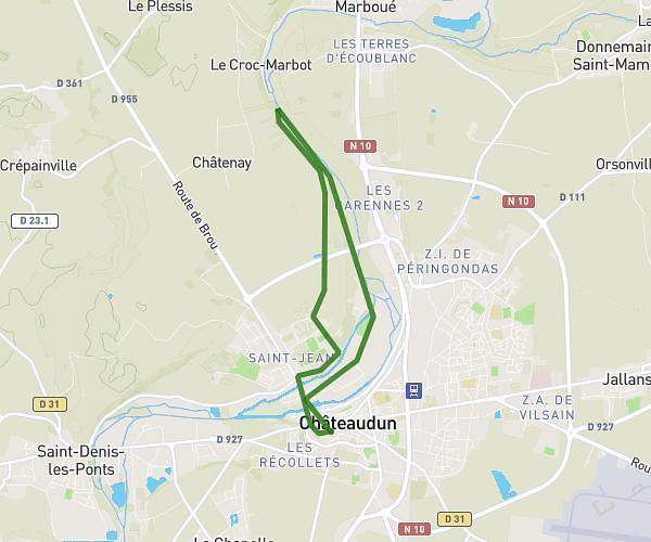
This running route covers 6.444mi starting from Marboué, Eure-et-Loir. The run is a loop trail and returns to the trailhead. This run is rated as moderate, expect about 1h9m to complete it. The route has an elevation gain of 377ft and an elevation loss of 377ft.
Cap 1
Route details
5.6mph
Speed
789 kcal
Calories burned
Loop trail
Route type
354ft
Min altitude
440ft
Max altitude
Route profile
377ft
Elevation gain
377ft
Elevation loss
354ft
Min altitude
440ft
Max altitude
How to get there
Trailhead: 44 Rue De La Gare, 28200 Marboué, France
GPS coordinates of the trailhead: 48.11387, 1.34136 / 48°6'49'' N, 1°20'28'' E