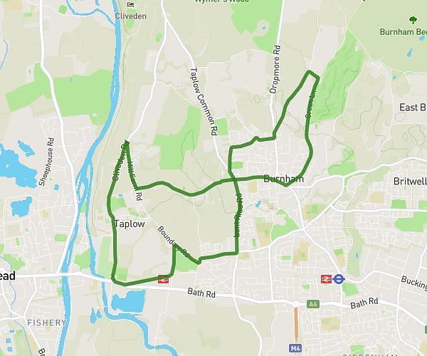
This running route covers 6.271mi starting from Slough, England. The run does not return to the trailhead and ends near Eight Acres, SL1 7AF Slough. This run is rated as moderate, expect about 40m22s to complete it. The route has an elevation gain of 282ft and an elevation loss of 236ft.
ludo
Route details
9.32mph
Speed
462 kcal
Calories burned
Point to point
Route type
92ft
Min altitude
207ft
Max altitude
Route profile
282ft
Elevation gain
236ft
Elevation loss
92ft
Min altitude
207ft
Max altitude
How to get there
Trailhead: Lent Rise Road, SL1 7BF Slough
GPS coordinates of the trailhead: 51.52887, -0.66686 / 51°31'43'' N, 0°40'0'' W