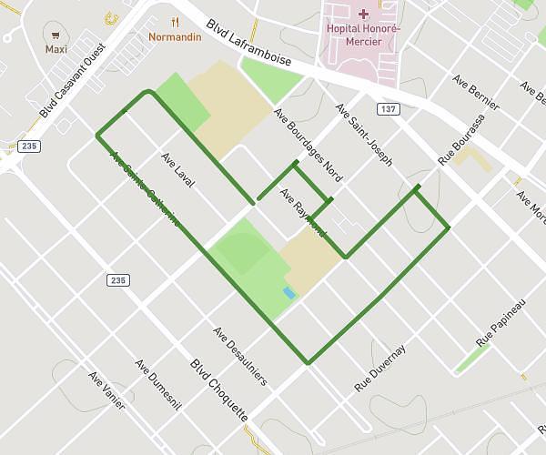
This running route covers 2.021mi starting from Saint-Hyacinthe, Quebec. The run is a loop trail and returns to the trailhead. This run is rated as easy, expect about 20m to complete it. The route has an elevation gain of 10ft and an elevation loss of 7ft.
3,2km
Route details
6.06mph
Speed
229 kcal
Calories burned
Loop trail
Route type
89ft
Min altitude
98ft
Max altitude
Route profile
10ft
Elevation gain
7ft
Elevation loss
89ft
Min altitude
98ft
Max altitude
How to get there
Trailhead: Avenue Chicoine, J2T 2W6 Saint-Hyacinthe
GPS coordinates of the trailhead: 45.63308, -72.93339 / 45°37'59'' N, 72°56'0'' W