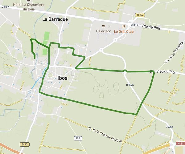
This running route covers 4.104mi starting from Barbazan-Debat, Hautes-Pyrénées. The run does not return to the trailhead and ends near 3 Avenue Pierre De Coubertin, 65000 Tarbes, France. This run is rated as easy, expect about 44m to complete it. The route has an elevation gain of 98ft and an elevation loss of 210ft.
Piscine
Route details
5.6mph
Speed
503 kcal
Calories burned
Point to point
Route type
1043ft
Min altitude
1168ft
Max altitude
Route profile
98ft
Elevation gain
210ft
Elevation loss
1043ft
Min altitude
1168ft
Max altitude
How to get there
Trailhead: 3 Rue Du Balaïtous, 65690 Barbazan-Debat, France
GPS coordinates of the trailhead: 43.195486, 0.114023 / 43°11'43'' N, 0°6'50'' E