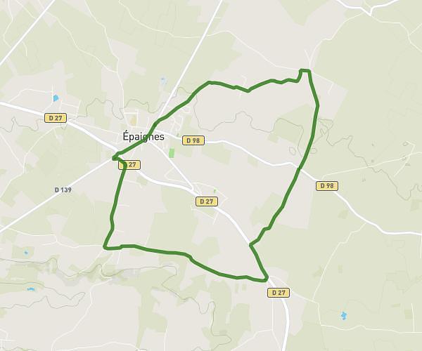
This walking route covers 3.288mi starting from Lisieux, Calvados. The walk is a loop trail and returns to the trailhead. This walk is rated as moderate, plan for about 48m to complete it. The route has an elevation gain of 180ft and an elevation loss of 184ft.
Marche du midi
Route details
14:36/mi
Pace
196 kcal
Calories burned
Loop trail
Route type
112ft
Min altitude
197ft
Max altitude
Route profile
180ft
Elevation gain
184ft
Elevation loss
112ft
Min altitude
197ft
Max altitude
How to get there
Trailhead: 110 Rue Paul Cornu, 14100 Lisieux, France
GPS coordinates of the trailhead: 49.16965, 0.218 / 49°10'10'' N, 0°13'4'' E