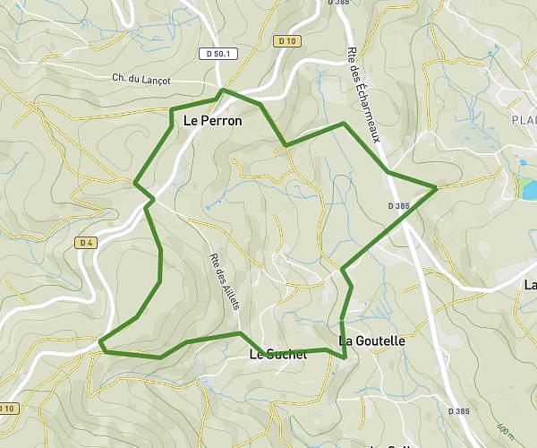
This running route covers 4.156mi starting from Chassigny-sous-Dun, Saône-et-Loire. The run is a loop trail and returns to the trailhead. This run is rated as easy, expect about 1h45m to complete it. The route has an elevation gain of 587ft and an elevation loss of 591ft.
Berraudiere
Route details
2.37mph
Speed
1201 kcal
Calories burned
Loop trail
Route type
1050ft
Min altitude
1293ft
Max altitude
Route profile
587ft
Elevation gain
591ft
Elevation loss
1050ft
Min altitude
1293ft
Max altitude
How to get there
Trailhead: 1205 Chemin Du Bey, 71170 Chassigny-sous-Dun, France
GPS coordinates of the trailhead: 46.24802, 4.28777 / 46°14'52'' N, 4°17'15'' E