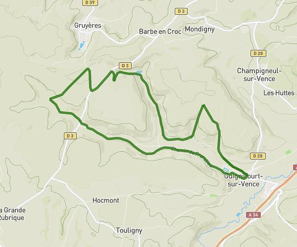
This hiking trail covers 4.723mi starting from Renwez, Ardennes. The hike is a loop trail and returns to the trailhead. This hike is rated as easy, plan for about 1h41m to complete it. The route has an elevation gain of 417ft and an elevation loss of 420ft.
triage forestier renwez
Route details
2.81mph
Speed
727 kcal
Calories burned
3.4%
Avg grade
Loop trail
Route type
840ft
Min altitude
1060ft
Max altitude
Route profile
417ft
Elevation gain
420ft
Elevation loss
840ft
Min altitude
1060ft
Max altitude
How to get there
Trailhead: 2 Chemin De La Pile, 08150 Renwez, France
GPS coordinates of the trailhead: 49.8422, 4.60075 / 49°50'31'' N, 4°36'2'' E