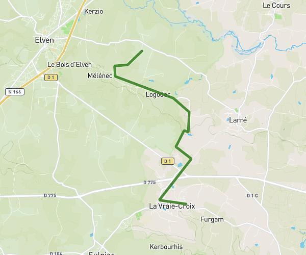
This hiking trail covers 4.816mi starting from Trédion, Morbihan. The hike does not return to the trailhead and ends near 6 Place De L'église, 56420 Plaudren, France. This hike is rated as easy, plan for about 1h45m to complete it. The route has an elevation gain of 374ft and an elevation loss of 367ft.
Rando plaudren
Route details
2.75mph
Speed
753 kcal
Calories burned
2.9%
Avg grade
Point to point
Route type
335ft
Min altitude
472ft
Max altitude
Route profile
374ft
Elevation gain
367ft
Elevation loss
335ft
Min altitude
472ft
Max altitude
How to get there
Trailhead: D 1, 56250 Trédion, France
GPS coordinates of the trailhead: 47.79984, -2.61612 / 47°47'59'' N, 2°36'58'' W