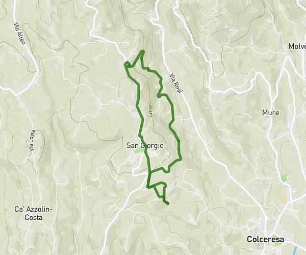
This running route covers 1.872mi starting from Enego, Vicenza. The run is a loop trail and returns to the trailhead. This run is rated as easy, expect about 20m to complete it. The route has an elevation gain of 299ft and an elevation loss of 308ft.
Enego
Route details
5.62mph
Speed
229 kcal
Calories burned
Loop trail
Route type
2457ft
Min altitude
2585ft
Max altitude
Route profile
299ft
Elevation gain
308ft
Elevation loss
2457ft
Min altitude
2585ft
Max altitude
How to get there
Trailhead: Via Zante 30, 36052 Enego Vicenza, Italy
GPS coordinates of the trailhead: 45.942405, 11.703246 / 45°56'32'' N, 11°42'11'' E