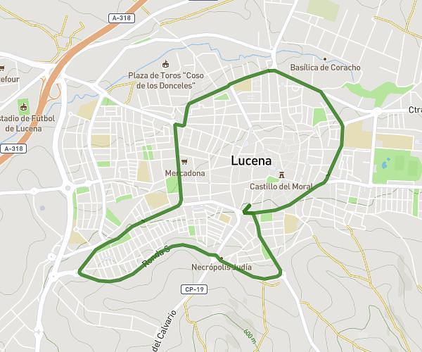
This running route covers 2.794mi starting from Lucena, Córdoba. The run is a loop trail and returns to the trailhead. This run is rated as easy, expect about 50m to complete it. The route has an elevation gain of 138ft and an elevation loss of 135ft.
Ronda
Route details
3.36mph
Speed
572 kcal
Calories burned
Loop trail
Route type
1519ft
Min altitude
1657ft
Max altitude
Route profile
138ft
Elevation gain
135ft
Elevation loss
1519ft
Min altitude
1657ft
Max altitude
How to get there
Trailhead: Calle Antonio Eulate 16, 14900 Lucena, Córdoba, Spain
GPS coordinates of the trailhead: 37.406173, -4.48618 / 37°24'22'' N, 4°29'10'' W