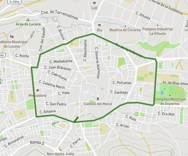
This running route covers 4.141mi starting from Lucena, Córdoba. The run is a loop trail and returns to the trailhead. This run is rated as easy, expect about 1h10m to complete it. The route has an elevation gain of 190ft and an elevation loss of 197ft.
Ronda grande
Route details
3.55mph
Speed
800 kcal
Calories burned
Loop trail
Route type
1529ft
Min altitude
1726ft
Max altitude
Route profile
190ft
Elevation gain
197ft
Elevation loss
1529ft
Min altitude
1726ft
Max altitude
How to get there
Trailhead: Calle Antonio Eulate 21, 14900 Lucena, Córdoba, Spain
GPS coordinates of the trailhead: 37.406136, -4.486149 / 37°24'22'' N, 4°29'10'' W