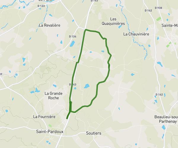
This hiking trail covers 5.313mi starting from Azay-sur-Thouet, Deux-Sèvres. The hike is a loop trail and returns to the trailhead. This hike is rated as moderate, plan for about 1h53m to complete it. The route has an elevation gain of 476ft and an elevation loss of 476ft.
l'Agenouillée
Route details
2.82mph
Speed
813 kcal
Calories burned
3.4%
Avg grade
Loop trail
Route type
538ft
Min altitude
689ft
Max altitude
Route profile
476ft
Elevation gain
476ft
Elevation loss
538ft
Min altitude
689ft
Max altitude
How to get there
Trailhead: Route De Parthenay, 79130 Azay-sur-Thouet, France
GPS coordinates of the trailhead: 46.620964, -0.364768 / 46°37'15'' N, 0°21'53'' W