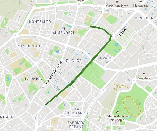
This walking route covers 2.928mi starting from Jerez de la Frontera, Cádiz. The walk is a loop trail and returns to the trailhead. This walk is rated as easy, plan for about 1h3m to complete it. The route has an elevation gain of 144ft and an elevation loss of 144ft.
Ruta 1
Route details
21:30/mi
Pace
257 kcal
Calories burned
Loop trail
Route type
121ft
Min altitude
197ft
Max altitude
Route profile
144ft
Elevation gain
144ft
Elevation loss
121ft
Min altitude
197ft
Max altitude
How to get there
Trailhead: Avenida De Sudamérica 1, 11407 Jerez de la Frontera, Cádiz, Spain
GPS coordinates of the trailhead: 36.70343, -6.12589 / 36°42'12'' N, 6°7'33'' W