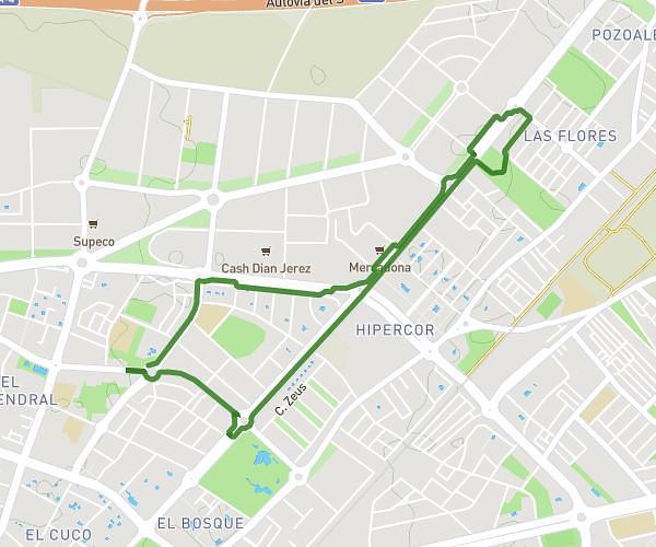
This walking route covers 3.205mi starting from Jerez de la Frontera, Cádiz. The walk is a loop trail and returns to the trailhead. This walk is rated as moderate, plan for about 1h9m to complete it. The route has an elevation gain of 236ft and an elevation loss of 240ft.
Ruta III
Route details
21:30/mi
Pace
282 kcal
Calories burned
Loop trail
Route type
167ft
Min altitude
207ft
Max altitude
Route profile
236ft
Elevation gain
240ft
Elevation loss
167ft
Min altitude
207ft
Max altitude
How to get there
Trailhead: Avenida De Sudamérica 1, 11407 Jerez de la Frontera, Cádiz, Spain
GPS coordinates of the trailhead: 36.703508, -6.126157 / 36°42'12'' N, 6°7'34'' W