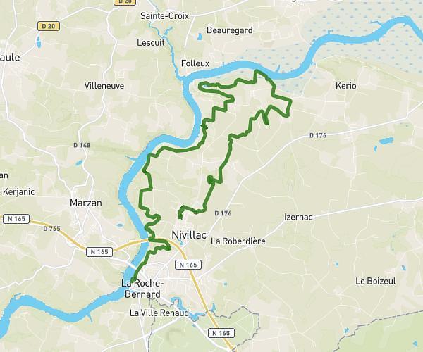
This running route covers 5.98mi starting from Nivillac, Morbihan. The run is a loop trail and returns to the trailhead. This run is rated as moderate, expect about 58m to complete it. The route has an elevation gain of 95ft and an elevation loss of 89ft.
Course andree chedid
Route details
6.19mph
Speed
663 kcal
Calories burned
Loop trail
Route type
39ft
Min altitude
135ft
Max altitude
Route profile
95ft
Elevation gain
89ft
Elevation loss
39ft
Min altitude
135ft
Max altitude
How to get there
Trailhead: 18 Rue De La Piscine, 56130 Nivillac, France
GPS coordinates of the trailhead: 47.51781, -2.29235 / 47°31'4'' N, 2°17'32'' W