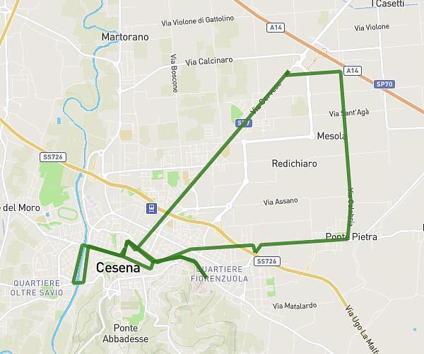
This running route covers 3.729mi starting from Forlì, Forlì-Cesena. The run does not return to the trailhead and ends near Via Cerchia 2, 47121 Forlì Forlì-Cesena, Italy. This run is rated as easy, expect about 31m30s to complete it. The route has an elevation gain of 13ft and an elevation loss of 20ft.
Forli 21/08
Route details
7.1mph
Speed
360 kcal
Calories burned
Point to point
Route type
79ft
Min altitude
92ft
Max altitude
Route profile
13ft
Elevation gain
20ft
Elevation loss
79ft
Min altitude
92ft
Max altitude
How to get there
Trailhead: Viale Roma 85a, 47122 Forlì Forlì-Cesena, Italy
GPS coordinates of the trailhead: 44.21388, 12.06039 / 44°12'49'' N, 12°3'37'' E