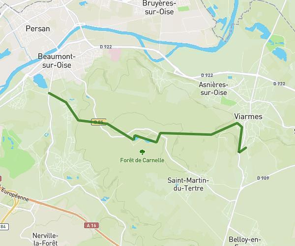
This hiking trail covers 6.015mi starting from Saint-Brice-sous-Forêt, Val-d'Oise. The hike is a loop trail and returns to the trailhead. This hike is rated as moderate, plan for about 1h2m to complete it. The route has an elevation gain of 732ft and an elevation loss of 735ft.
PISCOP 2 - 15 MARS 2026
Route details
5.82mph
Speed
451 kcal
Calories burned
4.6%
Avg grade
Loop trail
Route type
220ft
Min altitude
607ft
Max altitude
Route profile
732ft
Elevation gain
735ft
Elevation loss
220ft
Min altitude
607ft
Max altitude
How to get there
Trailhead: 59 Rue Jean Monnet, 95350 Saint-Brice-sous-Forêt, France
GPS coordinates of the trailhead: 49.011237, 2.349917 / 49°0'40'' N, 2°20'59'' E