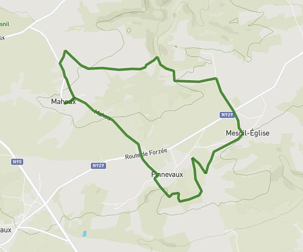
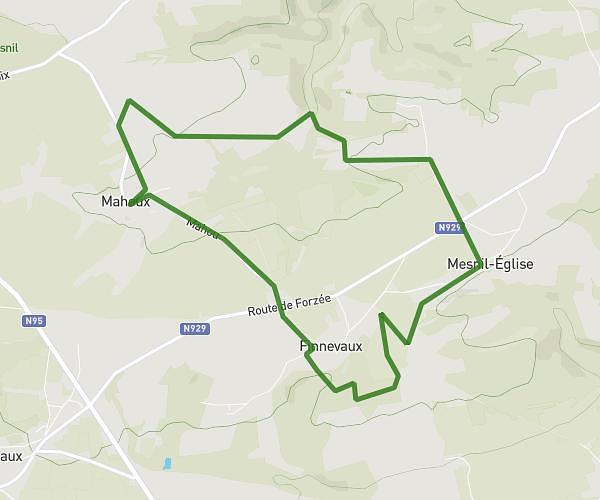
This walking route covers 4.35mi starting from Houyet, Namur. The walk is a loop trail and returns to the trailhead. This walk is rated as moderate, plan for about 1h33m to complete it. The route has an elevation gain of 617ft and an elevation loss of 614ft.
Mahoux gde route finnevaux
Route details
21:22/mi
Pace
380 kcal
Calories burned
Loop trail
Route type
653ft
Min altitude
889ft
Max altitude
Route profile
617ft
Elevation gain
614ft
Elevation loss
653ft
Min altitude
889ft
Max altitude
How to get there
Trailhead: Mahou, 5560 Houyet
GPS coordinates of the trailhead: 50.16745, 4.92465 / 50°10'2'' N, 4°55'28'' E