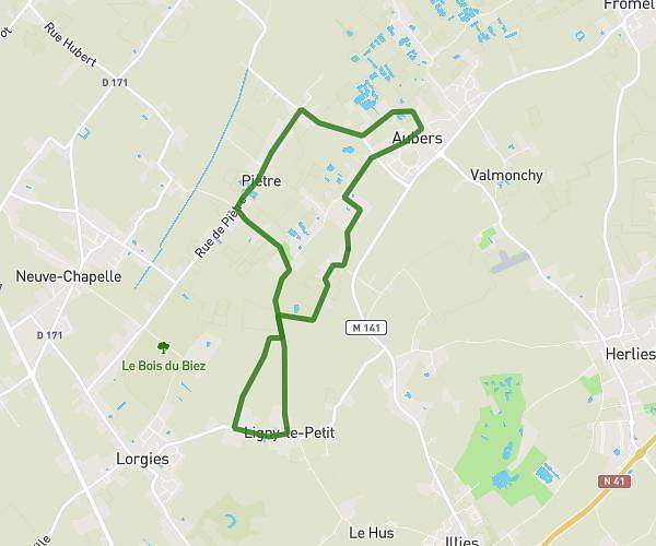
This hiking trail covers 3.754mi starting from Le Maisnil, Nord. The hike is a loop trail and returns to the trailhead. This hike is rated as easy, plan for about 1h16m to complete it. The route has an elevation gain of 118ft and an elevation loss of 125ft.
le maisnil 6KM
Route details
2.93mph
Speed
544 kcal
Calories burned
1.2%
Avg grade
Loop trail
Route type
52ft
Min altitude
92ft
Max altitude
Route profile
118ft
Elevation gain
125ft
Elevation loss
52ft
Min altitude
92ft
Max altitude
How to get there
Trailhead: 19 Rue De L'église, 59134 Le Maisnil, France
GPS coordinates of the trailhead: 50.615004, 2.884739 / 50°36'54'' N, 2°53'5'' E