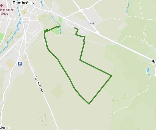
This hiking trail covers 4.752mi starting from Fontaine-Notre-Dame, Nord. The hike is a loop trail and returns to the trailhead. This hike is rated as easy, plan for about 2h39m to complete it. The route has an elevation gain of 190ft and an elevation loss of 190ft.
Fontaine Notre Dame
Route details
1.8mph
Speed
1127 kcal
Calories burned
1.5%
Avg grade
Loop trail
Route type
190ft
Min altitude
292ft
Max altitude
Route profile
190ft
Elevation gain
190ft
Elevation loss
190ft
Min altitude
292ft
Max altitude
How to get there
Trailhead: 1002 Route Nationale, 59400 Fontaine-Notre-Dame, France
GPS coordinates of the trailhead: 50.1677, 3.16429 / 50°10'3'' N, 3°9'51'' E