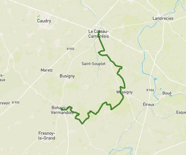
This hiking trail covers 3.61mi starting from Le Cateau-Cambrésis, Nord. The hike does not return to the trailhead and ends near Chemin Terrain 4x4, 59360 Le Cateau-Cambrésis, France. This hike is rated as easy, plan for about 1h to complete it. The route has an elevation gain of 131ft and an elevation loss of 200ft.
Dernière la maison
Route details
3.61mph
Speed
425 kcal
Calories burned
1.7%
Avg grade
Point to point
Route type
371ft
Min altitude
479ft
Max altitude
Route profile
131ft
Elevation gain
200ft
Elevation loss
371ft
Min altitude
479ft
Max altitude
How to get there
Trailhead: 37 Rue Albert Schweitzer, 59360 Le Cateau-Cambrésis, France
GPS coordinates of the trailhead: 50.099552, 3.560169 / 50°5'58'' N, 3°33'36'' E