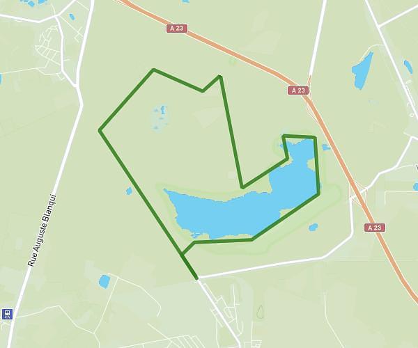
This hiking trail covers 3.985mi starting from Dechy, Nord. The hike is a loop trail and returns to the trailhead. This hike is rated as easy, plan for about 1h22m to complete it. The route has an elevation gain of 161ft and an elevation loss of 164ft.
Marche rose
Route details
2.91mph
Speed
581 kcal
Calories burned
1.5%
Avg grade
Loop trail
Route type
95ft
Min altitude
148ft
Max altitude
Route profile
161ft
Elevation gain
164ft
Elevation loss
95ft
Min altitude
148ft
Max altitude
How to get there
Trailhead: 255 Rue Esther Duflo, 59187 Dechy, France
GPS coordinates of the trailhead: 50.339083, 3.107148 / 50°20'20'' N, 3°6'25'' E