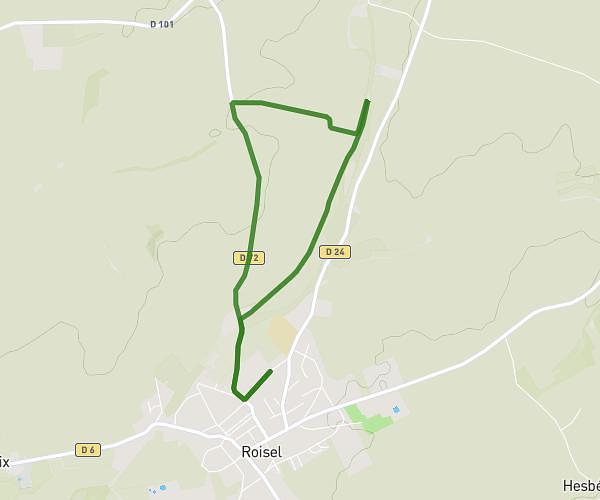
This hiking trail covers 10.241mi starting from Roisel, Somme. The hike is a loop trail and returns to the trailhead. This hike is rated as moderate, plan for about 3h28m to complete it. The route has an elevation gain of 807ft and an elevation loss of 807ft.
4 montees de la boule bleue.
Route details
2.95mph
Speed
1493 kcal
Calories burned
3.0%
Avg grade
Loop trail
Route type
236ft
Min altitude
466ft
Max altitude
Route profile
807ft
Elevation gain
807ft
Elevation loss
236ft
Min altitude
466ft
Max altitude
How to get there
Trailhead: 34 Rue Massenet, 80240 Roisel, France
GPS coordinates of the trailhead: 49.950345, 3.101781 / 49°57'1'' N, 3°6'6'' E