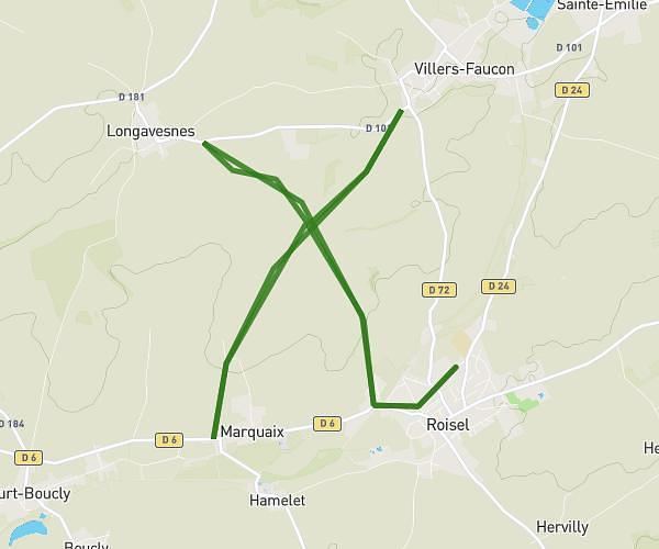
This hiking trail covers 3.829mi starting from Roisel, Somme. The hike is a loop trail and returns to the trailhead. This hike is rated as easy, plan for about 42m to complete it. The route has an elevation gain of 253ft and an elevation loss of 253ft.
Rroisel vers Villers faucon retour par ancienne voie ferrée.6km
Route details
5.47mph
Speed
300 kcal
Calories burned
2.5%
Avg grade
Loop trail
Route type
236ft
Min altitude
348ft
Max altitude
Route profile
253ft
Elevation gain
253ft
Elevation loss
236ft
Min altitude
348ft
Max altitude
How to get there
Trailhead: 30 Rue Massenet, 80240 Roisel, France
GPS coordinates of the trailhead: 49.950221, 3.101521 / 49°57'0'' N, 3°6'5'' E