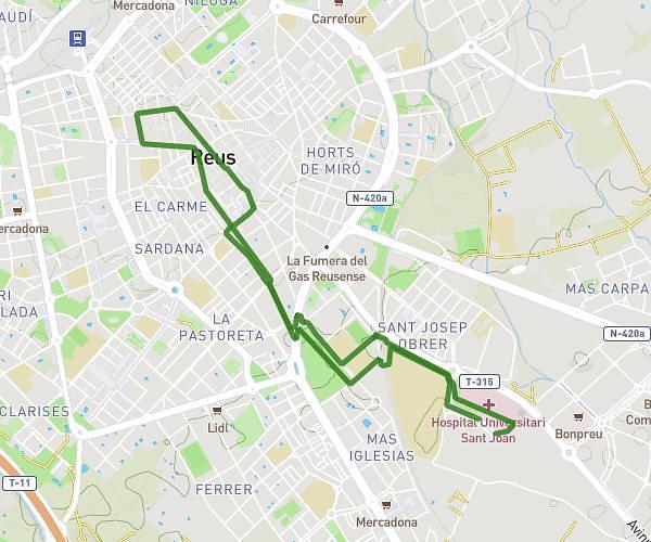
This running route covers 3.909mi starting from Reus, Tarragona. The run is a loop trail and returns to the trailhead. This run is rated as easy, expect about 1h to complete it. The route has an elevation gain of 325ft and an elevation loss of 328ft.
6km
Route details
3.91mph
Speed
686 kcal
Calories burned
Loop trail
Route type
331ft
Min altitude
482ft
Max altitude
Route profile
325ft
Elevation gain
328ft
Elevation loss
331ft
Min altitude
482ft
Max altitude
How to get there
Trailhead: Passeig De Prim 14, 43202 Reus, Tarragona, Spain
GPS coordinates of the trailhead: 41.152555, 1.102803 / 41°9'9'' N, 1°6'10'' E