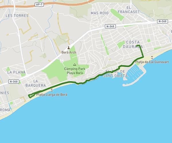
This running route covers 4.169mi starting from Tarragona, Tarragona. The run does not return to the trailhead and ends near Avinguda President Tarradellas 6a, 43100 Tarragona, Tarragona, Spain. This run is rated as easy, expect about 45m to complete it. The route has an elevation gain of 358ft and an elevation loss of 374ft.
6,5km
Route details
5.56mph
Speed
515 kcal
Calories burned
Point to point
Route type
49ft
Min altitude
200ft
Max altitude
Route profile
358ft
Elevation gain
374ft
Elevation loss
49ft
Min altitude
200ft
Max altitude
How to get there
Trailhead: Camí De La Partió 2, 43100 Tarragona, Tarragona, Spain
GPS coordinates of the trailhead: 41.122925, 1.193825 / 41°7'22'' N, 1°11'37'' E