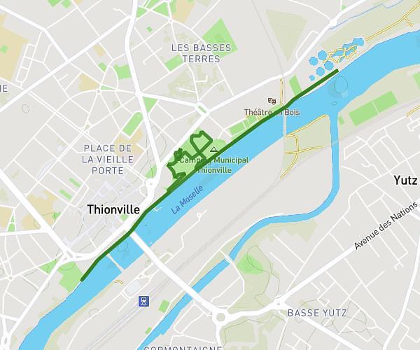
This running route covers 6.275mi starting from Yutz, Moselle. The run is a loop trail and returns to the trailhead. This run is rated as moderate, expect about 47m14s to complete it. The route has an elevation gain of 230ft and an elevation loss of 230ft.
YUTZ Moselle/Aéro
Route details
7.97mph
Speed
540 kcal
Calories burned
Loop trail
Route type
482ft
Min altitude
594ft
Max altitude
Route profile
230ft
Elevation gain
230ft
Elevation loss
482ft
Min altitude
594ft
Max altitude
How to get there
Trailhead: Rue De Bourgogne, 57970 Yutz
GPS coordinates of the trailhead: 49.35023, 6.18552 / 49°21'0'' N, 6°11'7'' E