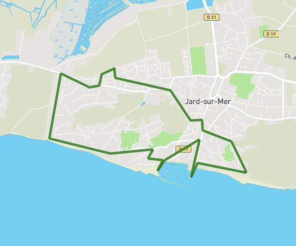
This cycling route covers 18.599mi starting from Talmont-Saint-Hilaire, Vendée. The ride does not return to the trailhead and ends near 311 Rue Du Port De La Guittière, 85440 Talmont-Saint-Hilaire, France. This route is rated as moderate, plan for about 1h52m to complete it. The route has an elevation gain of 85ft and an elevation loss of 148ft.
THALMONT SOLEX PARTIE 1
Route details
981 kcal
Calories burned
0.2%
Avg grade
Point to point
Route type
16ft
Min altitude
89ft
Max altitude
Route profile
85ft
Elevation gain
148ft
Elevation loss
16ft
Min altitude
89ft
Max altitude
How to get there
Trailhead: 30 Rue Des Piniers, 85440 Talmont-Saint-Hilaire, France
GPS coordinates of the trailhead: 46.46171, -1.65697 / 46°27'42'' N, 1°39'25'' W