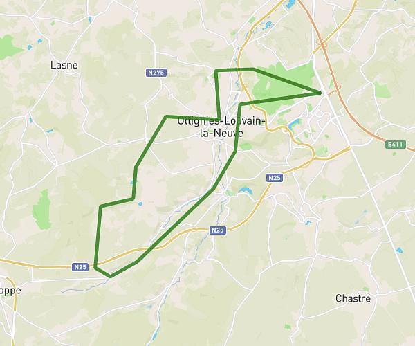
This hiking trail covers 4.467mi starting from Lasne, Walloon Brabant. The hike does not return to the trailhead and ends near Ruelle Quimbin 6, 1380 Lasne, Walloon Brabant, Belgium. This hike is rated as easy, plan for about 4h to complete it. The route has an elevation gain of 361ft and an elevation loss of 387ft.
hike 7km Lasne
Route details
1.12mph
Speed
1723 kcal
Calories burned
3.2%
Avg grade
Point to point
Route type
266ft
Min altitude
410ft
Max altitude
Route profile
361ft
Elevation gain
387ft
Elevation loss
266ft
Min altitude
410ft
Max altitude
How to get there
Trailhead: Rue Du Vieux Monument 2, 1380 Lasne, Walloon Brabant, Belgium
GPS coordinates of the trailhead: 50.68349, 4.4752 / 50°41'0'' N, 4°28'30'' E