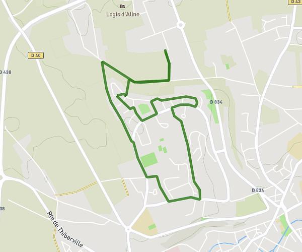
This hiking trail covers 2.615mi starting from Amfreville-Saint-Amand, Eure. The hike is a loop trail and returns to the trailhead. This hike is rated as easy, plan for about 1h to complete it. The route has an elevation gain of 33ft and an elevation loss of 33ft.
Remise en forme
Route details
2.62mph
Speed
422 kcal
Calories burned
0.5%
Avg grade
Loop trail
Route type
502ft
Min altitude
528ft
Max altitude
Route profile
33ft
Elevation gain
33ft
Elevation loss
502ft
Min altitude
528ft
Max altitude
How to get there
Trailhead: Rue Des Perelles, 27370 Amfreville-Saint-Amand
GPS coordinates of the trailhead: 49.2071, 0.9301 / 49°12'25'' N, 0°55'48'' E