MapPlanner
3.464mi
Distance
55m
Duration
15:53/mi
Pace
Easy
Level

9/13/2022

Route details

15:53/mi
Pace
225 kcal
Calories burned
Loop trail
Route type
509ft
Min altitude
636ft
Max altitude

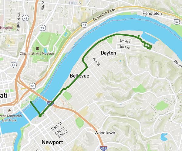
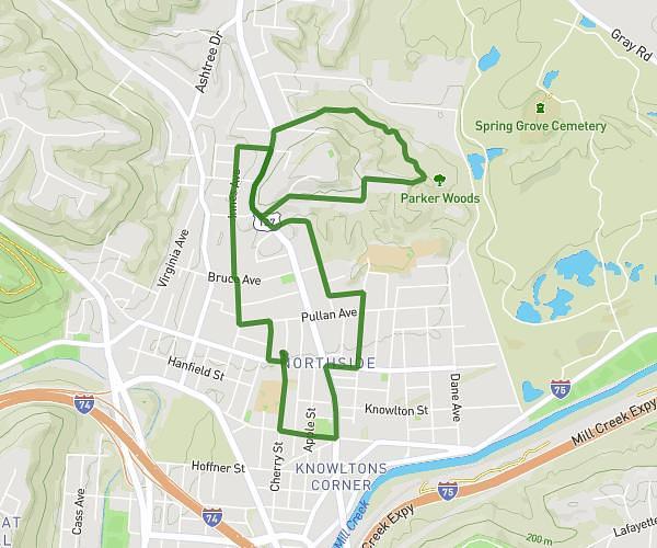
This walking route covers 3.464mi starting from Cincinnati, Ohio. The walk is a loop trail and returns to the trailhead. This walk is rated as easy, plan for about 55m to complete it. The route has an elevation gain of 138ft and an elevation loss of 128ft.

Description of the route by the creator

Comet Evening walk

Route profile

138ft
Elevation gain
128ft
Elevation loss
509ft
Min altitude
636ft
Max altitude

How to get there

Trailhead: 4209 Cherry Street, Cincinnati, Ohio 45223, United States

GPS coordinates of the trailhead: 39.16389, -84.54245 / 39°9'50'' N, 84°32'32'' W

Caution: May Cross Private Property

This route may pass through or near private property. Always respect posted signs, obtain permission where required, and follow local trespassing laws. MapPlanner does not guarantee public access along any route.

Safety Notice

Trail and road conditions may change without notice due to weather, construction, or other factors. Always verify current conditions before heading out. You are responsible for your own safety — follow local signage, obey traffic laws, and use your best judgment on the trail.