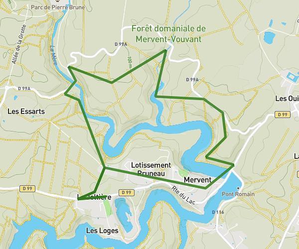
This hiking trail covers 6.8mi starting from Mervent, Vendée. The hike does not return to the trailhead and ends near D 99, 85200 Mervent, France. This hike is rated as hard, plan for about 49m to complete it. The route has an elevation gain of 1033ft and an elevation loss of 1020ft.
canirando 2
Route details
8.33mph
Speed
359 kcal
Calories burned
5.7%
Avg grade
Point to point
Route type
131ft
Min altitude
374ft
Max altitude
Route profile
1033ft
Elevation gain
1020ft
Elevation loss
131ft
Min altitude
374ft
Max altitude
How to get there
Trailhead: D 99, 85200 Mervent, France
GPS coordinates of the trailhead: 46.521429, -0.769107 / 46°31'17'' N, 0°46'8'' W