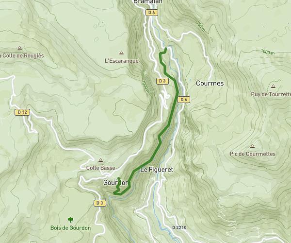
This hiking trail covers 3.107mi starting from Gréolières, Alpes-Maritimes. The hike does not return to the trailhead and ends near 06620, Gréolières, Alpes-Maritimes, France. This hike is rated as hard, plan for about 2h33m to complete it. The route has an elevation gain of 2480ft and an elevation loss of 1739ft.
Greolieres Deco 700
Route details
1.22mph
Speed
1341 kcal
Calories burned
25.7%
Avg grade
Point to point
Route type
2677ft
Min altitude
5121ft
Max altitude
Steep climb
Route profile
2480ft
Elevation gain
1739ft
Elevation loss
2677ft
Min altitude
5121ft
Max altitude
How to get there
Trailhead: Esplanade Jean Mane, 06620 Gréolières, France
GPS coordinates of the trailhead: 43.796242, 6.947071 / 43°47'46'' N, 6°56'49'' E